
Mansfield Neighbors by Block
A block-level lookup is a layered record task. The parcel map gives spatial relationships, the assessor gives a dated owner or mailing snapshot, permits show project roles, and civic sources show public activity around a street or district. The voter system has its own state rules. Historical directories may help with past households, but no verified current Mansfield occupant directory was located.
| Source | What it shows about a block | Access |
|---|---|---|
| AxisGIS parcel map | Parcel boundaries, situs addresses, map layers, adjacent parcels, and public parcel fields | Public web map; live card and report fields can change. |
| Mansfield map index | Subdivisions, rights-of-way, roads, utility material, floor plans, map owners, book and page | Town PDF or RecordHub follow-up. |
| Mansfield Assessor / Grand List | Dated location, map/block/lot, assessment, sale, year-built, living-SF, and volume/page fields | Assessor and AxisGIS route; annual snapshots. |
| Permit case status | Address, APN, owner, project, permit/date, status, fee, contact, and estimated-cost fields | Online search and export controls; date span not located. |
| SOTS voter route | Permitted registration fields, district, party/status, and participation history when displayed | State public lookup and separate certified file rules. |
| Boards and Committees / Agenda Center | Public officials, appointees, applicants, meeting topics, minutes, and decisions | Official public documents; not a private member list. |
| Downtown Partnership | Public umbrella organization, committees, and Downtown Storrs activity | Organization page; no household directory. |
| College Park and White Oak association signals | Association or condominium names appearing in town land or assessment context | Search the public record; member lists were not verified. |
| Mansfield library and historical leads | Past address-to-occupant clues, local history, house files, and organization records | Reference, library-card, or appointment route; exact criss-cross run not verified. |
The table separates what the record actually shows from the word “neighbors.” A parcel next to yours is a spatial neighbor. A named owner is an owner-of-record at a date. A civic participant is visible in a public role. None of those facts, alone, identifies every person who lives in a home.
Mansfield Neighbors: 100-Foot Lens
The inspected AxisGIS configuration includes an adjacent-parcel or abutters tool set around 100 feet. The current interface wording and unit should be checked in a live view before publication because map controls can change. The tool is spatial. It identifies nearby parcels or mapped results, not household members, delivery records, or a verified list of people who occupy the surrounding homes.
Use the address-to-adjacent-parcels flow below. Keep the output to parcel IDs, map relationships, source dates, and the record role needed for the question.
- Normalize the full address with the civil town, postal locality, street suffix, unit or lot, and current ZIP. USPS is the delivery check; Mansfield remains the civil town.
- Search the address or street in AxisGIS and capture the PID, ParcelNumber, GIS or CAMA number, PropertyAddress, OwnerName, OwnerAddress, assessment label, and map position.
- Set or confirm the adjacent-parcel distance shown by the live tool. Click the surrounding parcels and record spatial relation, not a conclusion about who lives there.
- Check the map index, assessor sales, and permit case by the parcel or APN when a road, lot, project, or dated owner question needs support.
- For a whole named street, use the Mansfield by-street walkthrough after the block is understood. The block tool and the street chain answer different questions.
AxisGIS warns that its map and tax data are public information, illustrative, and not a field survey. A map click is a good start for orientation. It is not a substitute for the Town Clerk’s legal record or a source that proves current occupancy.
Mansfield Neighbors and Address Labels
Mansfield, Mansfield Center, Storrs, and Storrs-Mansfield are not interchangeable search fields. Mansfield is the civil town. Mansfield Center and Storrs are local and postal labels, and Storrs can also signal a UConn setting or an institutional mailing address. A ZIP result belongs to the postal route. A PropertyAddress belongs to the parcel map. An OwnerAddress belongs to a tax or mailing field. Keep each label in its own column.
For an older block, add Mansfield Depot, historic road names, farm names, house names, and former county labels. A map index may use a street heading, while a deed uses a legal description and a campus collection uses Storrs. Search each variant, then connect them with a PID, map book/page, road crossing, house title, or dated source. Do not silently rewrite a printed label to fit a modern city field.
The postal check should be made with the complete address. A 06250, 06268, 06269, or historical 06251 clue narrows the next step, but it does not define a parcel, district, or household.
Mansfield Neighbors: Maps and APNs
The Mansfield street-name map index is a block-history tool as much as a parcel tool. Its fields include street name, map title, book, page, filed date, and description. Descriptions may refer to subdivisions, proposed roads, rights-of-way, utility material, town property, or floor plans. The map-owner index adds an owner-name path when a subdivision or former map owner is the better clue.
The Town says map indexes begin in 1913, and the posted street-name section runs from January 1, 1927 through December 31, 2024. Use the map book and page to reach the underlying land record. A map is not automatically a current parcel boundary, and an APN is not a person. It is a key that lets the assessor, permit portal, and GIS view speak about the same land.
Association names can surface in these records without exposing a roster. College Park Homeowners Association and White Oak Condominiums or Association are documented as name signals in town land or assessment context. The name may help locate a filing, map, or public meeting. It does not authorize copying private member names or contact details.
Mansfield Neighbors: Permit Clues
Mansfield OnlineGovt case status accepts address, APN#, owner name, permit number, and permit date controls across building and related case routes. A result can expose an address, APN, owner or owner address, description of work, permit date, issued date, fee total, status, project name, contacts, estimated cost, and an ID. The current searchable date range was not located. A permit contact may be a project participant rather than a title holder or occupant.
The assessor layer supplies a different dated snapshot. The 2024 and 2025 Grand List house-sales tables show date, style, location, assessment, sale price, volume/page, acreage, year built, living SF, map/block/lot, and bedrooms. Compare the annual sales entry with the AxisGIS parcel and the Town Clerk deed. Do not treat a sale table as a complete owner history or a current household record.
A strong block note says exactly what each field did: “APN matched the parcel,” “permit case listed an owner role,” or “2025 sales PDF carried a location and map/block/lot.” That wording keeps nearby properties from becoming unsupported neighbor profiles.
Mansfield Neighbors and Voter Limits
Connecticut voter data is centralized through the Secretary of the State, with the Mansfield Registrar maintaining the local registration function. The public lookup route is intended to use a town, first name, last name, and date-of-birth path, but the official endpoint returned a web-application firewall response during research. The current public fields and result layout should be checked through the ordinary official route, not bypassed.
Connecticut rules make certain registration fields public, including name, permitted address or mailing information, voting district, and party status, while sensitive identifiers remain protected. Current 2026 material limits public birth information to the year. Participation history can show that a person took part in an election or primary after the update window, but it does not show a ballot choice. A statewide CSV is a separate $300 request with purpose certification and use limits. It is not a personal ZIP or block list.
For a block question, voter data is one dated civic signal. It does not prove that a person was physically present on election day, owns a parcel, or belongs to every address near the search point. Protected voters and substitute addresses must stay protected.
Civic Contacts for Mansfield Neighbors
Public civic contacts help a block search move from parcel geography to the organizations and offices that actually serve Mansfield. The town’s phone directory is an office list, not a current resident register. It is useful for routing a records question to the custodian without exposing private details.
The Mansfield municipal phone directory is the source captured for the public contact view below.
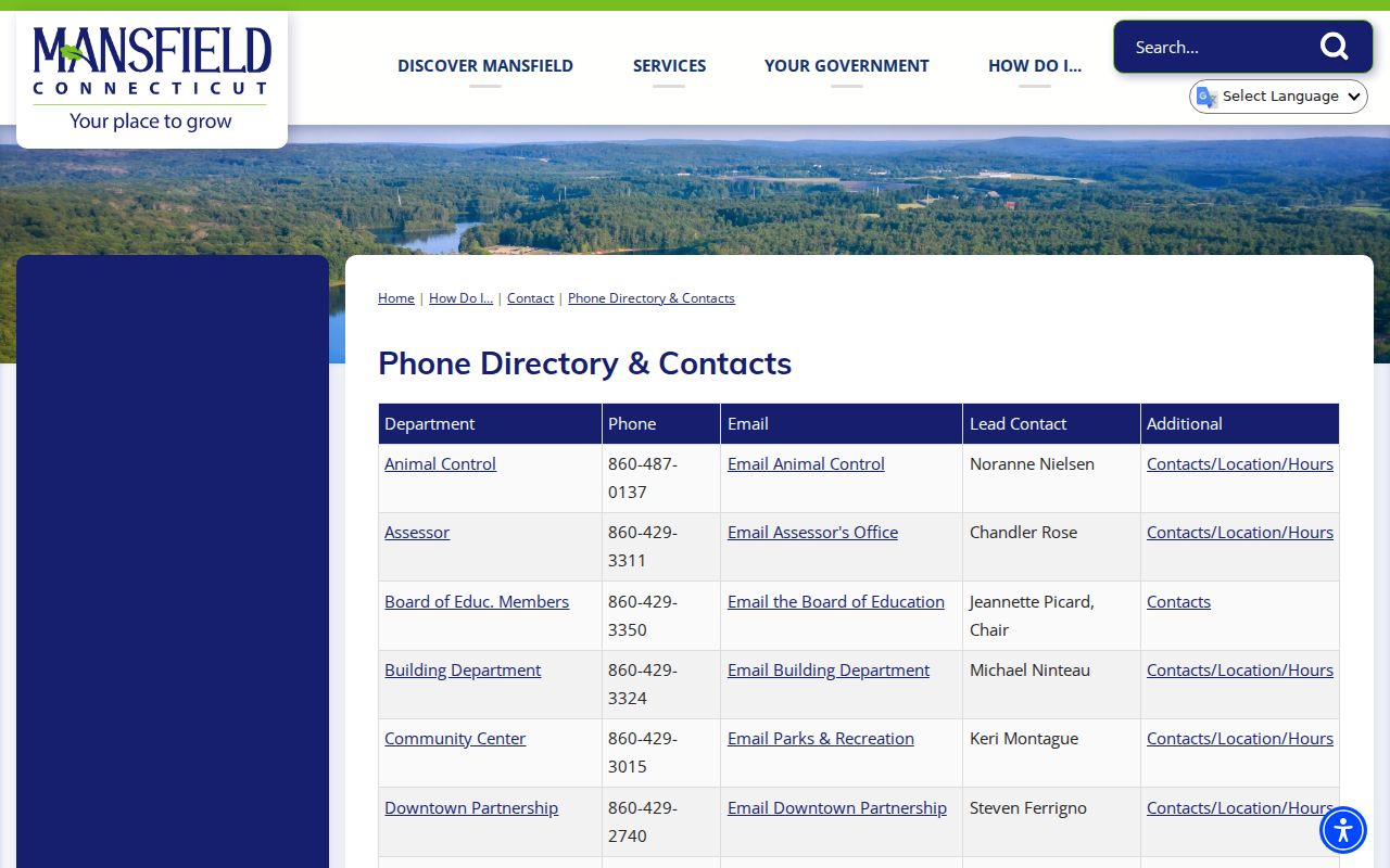
The directory image supports office-level routing. It does not turn the phone list into a list of nearby households.
| Public organization or office | Block-related role | Public contact or access |
|---|---|---|
| Mansfield Town Clerk | Land records, maps, FOI, vital, trade-name, cemetery, and town record routing | 860-429-3302; 4 S Eagleville Road |
| Mansfield Registrar of Voters | Registration, canvass, elections, referenda, and voter-information route | 860-429-3368; state public lookup rules apply |
| Mansfield Public Library | Local History Archive, newspapers, licensed genealogy databases, and reference help | 860-423-2501; library and collection access rules apply |
| Downtown Storrs Partnership | Public community and business umbrella for Downtown Storrs | 860-429-2740; public organization page |
Mansfield Neighbors: Downtown Groups
The Downtown Storrs Partnership is a Town and UConn-linked nonprofit at 23 Royce Circle, P.O. Box 513, Storrs Mansfield. It is a community signal for public events, committees, and downtown activity. It is not a list of homes or a private association roster. A block near Storrs can therefore have an institutional, civic, or commercial connection that does not describe every household nearby.
The Downtown Partnership page is the source captured for the public organization view below.
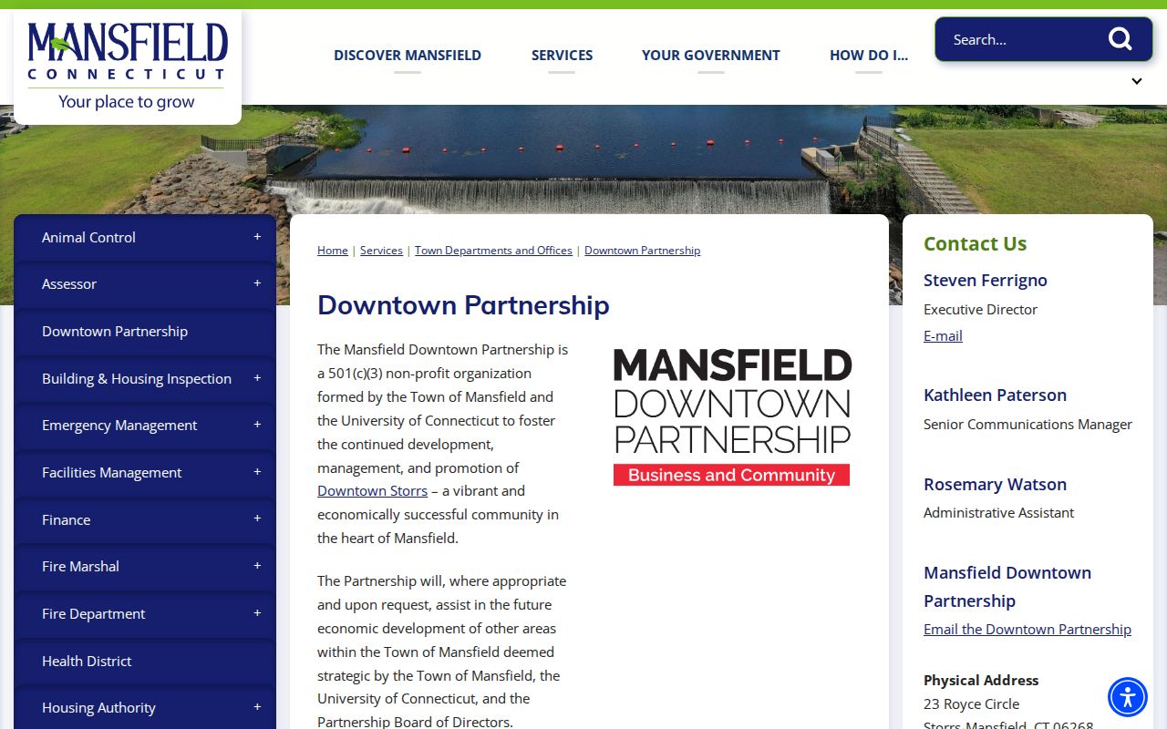
The image connects a block search to a named public organization. The organization’s role and contact path are public; private member details are not assumed.
The Mansfield Agenda Center is the source captured for meeting and document access below.
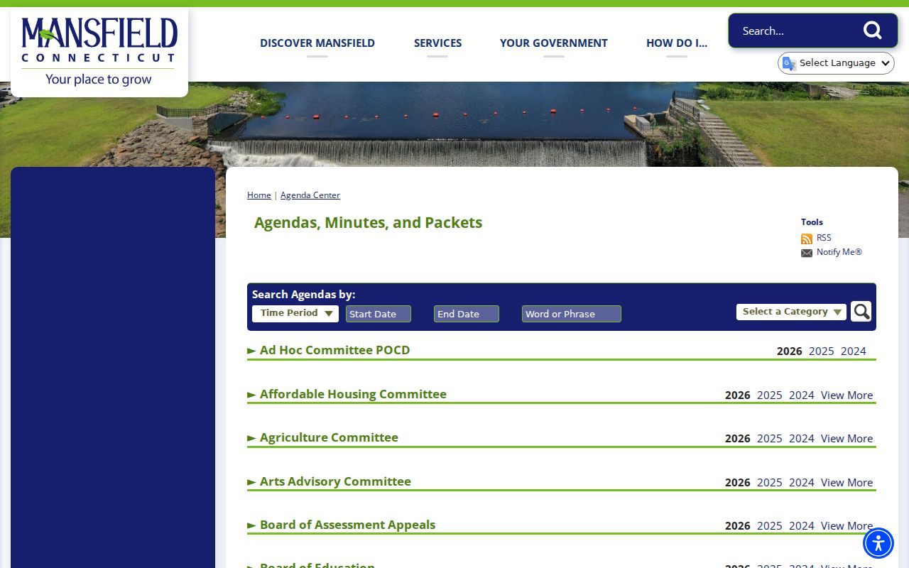
Agendas and minutes can show public applicants, board roles, street references, and decisions. They show participation in a public process, not the private membership of a block.
Mansfield Neighbors: Association Signals
Association names can help a researcher understand a subdivision or shared parcel context, but they should remain signals. College Park and White Oak names surfaced in town land or assessment-related records. The record may identify an association or condominium name tied to a map, parcel, or filing. It did not establish a complete public directory of members, officers, or household occupants.
The Mansfield town archive is the source captured for the archive search view below. Its search fields include keywords, archive category, time period, and start and end dates, with coverage that depends on uploaded documents.
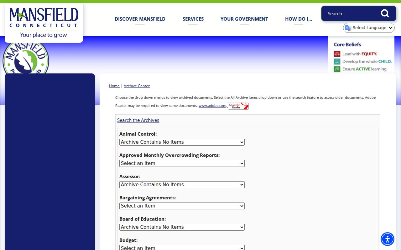
Use an association name to find a public map, meeting file, or recorded document. Do not copy a private roster from a live result, and do not infer that an association name identifies every person on its parcels.
Mansfield Neighbors: Cemetery Clues
Cemeteries add a historical and community layer around a Mansfield block. The Town lists 21 known cemeteries, including town-owned, inactive, university-associated, and religious places. That list can point a family-history search toward a cemetery name, sexton, church, or Historical Society lead. It is not an online interment-name index and does not prove that a living person is connected to a nearby parcel.
The Mansfield cemetery list is the source captured for the place view below.
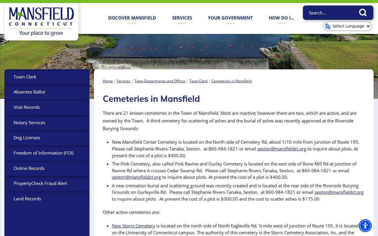
The cemetery image is a place index. For a named burial, follow the Town Clerk, cemetery, church, archive, or genealogy custodian route and preserve the transcription date.
Mansfield Neighbors and Official Records
Different source categories may all claim to help find neighbors, but they do not carry the same evidence. The comparison below keeps the commercial category unnamed and gives the official record a defined role.
| Source category | Useful block signal | Limit to state clearly |
|---|---|---|
| Official parcel, map, assessor, and permit records | Address, parcel, owner or mailing fields, map filings, project dates, and public record roles | Dated snapshots; no complete household or occupant proof. |
| Official voter and civic records | Permitted registration fields, districts, public officers, meeting participants, and decisions | State privacy rules apply; no ballot choice or private membership roster. |
| Commercial people-finder category | A possible name or address lead assembled from mixed sources | Freshness, identity matching, cost, deletion, and source provenance vary; verify with a custodian. |
When a block record is missing online, the fallback is a narrow written request to the Town under the Connecticut Freedom of Information Act. Give the record type, address or parcel, date range, department or custodian, contact information, and preferred format. Mansfield says it acknowledges requests within four business days. Copy fees, exemptions, redactions, and a possible FOI Commission appeal still apply. A focused request is more useful than asking for every person connected to a street.
Mansfield Neighbor Privacy
Connecticut’s Address Confidentiality Program and voter-privacy process can replace or suppress an actual residential address for a qualifying person. C.G.S. §1-217 also provides a nondisclosure route for specified protected people. A redacted address is a lawful privacy result. It is not an invitation to reconstruct the location from an adjacent parcel, map, permit, voter file, or postal clue.
Keep a public block explanation narrow. Use parcel IDs, map references, agency names, dates, public roles, and source URLs when those details answer the question. Avoid copying full birth dates, DMV identifiers, signatures, private contact details, or unnecessary delivery information. If an address is protected, leave it protected across every source.
Lawful use. Mansfield neighbor research is for understanding a block, civic participation, family history, reconnecting, and personal safety awareness. Do not use parcel adjacency, voter data, meetings, or association signals to stalk, harass, intimidate, or track a living person. Contact the appropriate public office for a lawful safety concern.